The challenge
Developing new knowledge about the subsurface and understanding Earth systems are science challenges in themselves. This knowledge is crucial in that it provides the foundations for improving the use of resources (e.g. water, energy, minerals and metals), adapting to the impacts of climate change, anticipating and mitigating natural risks and taking these into account in spatial planning.
This challenge area is relevant to planners, economic operators, environmental managers, education providers, civil society and the wider public. It is core to the mission of BRGM and other European and global geological surveys. To fulfil this mission today, we must fully exploit the new opportunities of digital technologies while continuing to acquire reliable reference knowledge incorporating modern geological concepts. We must also improve the dissemination of resulting subsurface knowledge in formats tailored to different purposes and uses of the underground.
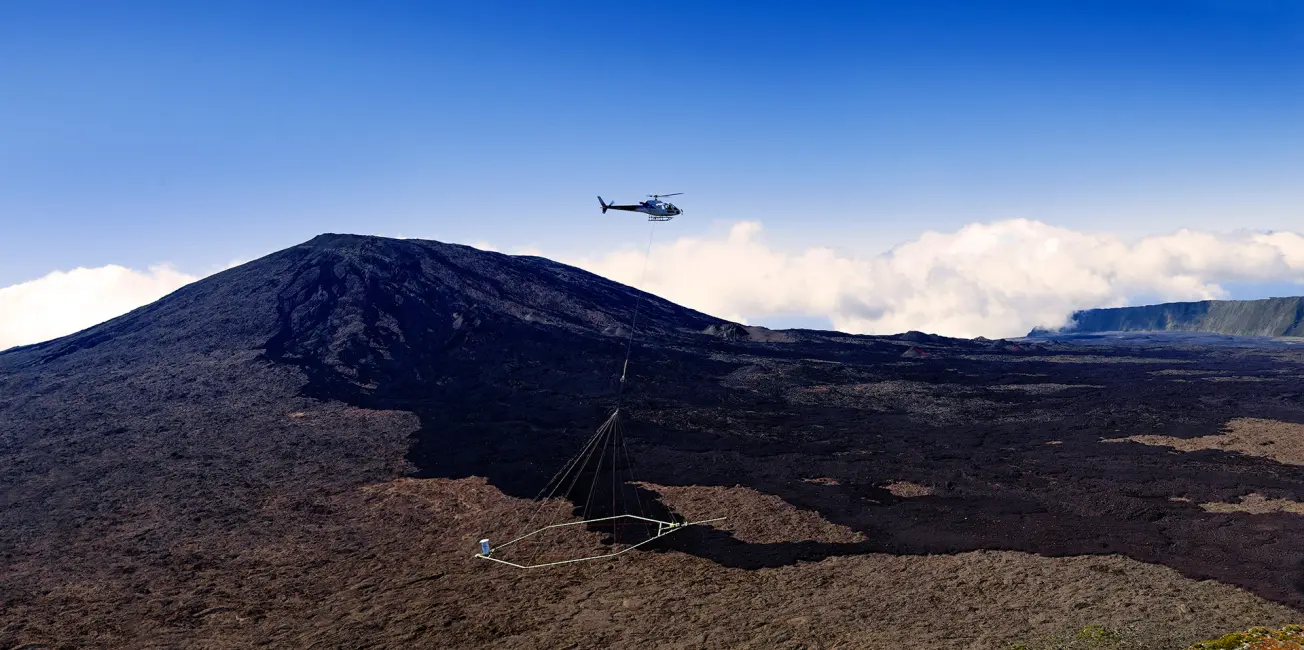
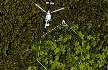
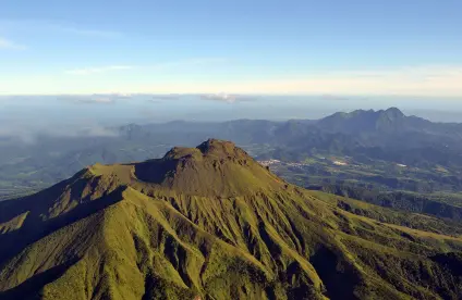
Heliborne geophysical survey of La Réunion.
© BRGM - René Carayol
The ambition of BRGM
In response to this challenge, BRGM's ambition is to produce reference information on the subsurface by acquiring new knowledge and inspiring the national community of geologists through its "French Geological Reference Platform" programme.
This programme aims to :
- produce, pool and structure geoscience knowledge into a reference repository that represents what we know coherently and comprehensively ;
- understand geodynamic changes affecting geological systems and their effect on deep and shallow material movements ;
- characterise, visualise and model the subsurface architecture to support resource users, risk managers, planners and developers.
In this context, two complementary science programmes are being implemented: “knowledge of geological systems” and “subsurface imaging and modelling”.
Our solutions
Latest news
Our references and projects
Results and data
Websites, apps and databases
Discovering the Earth Sciences

Scientific programme: Knowledge of geological systems
BRGM’s work focuses on geological processes and units as they relate to natural resources (e.g. minerals, water and energy), hazards and spatial planning. We provide a continuum between solving research questions, fulfilling the need for expert advice and contributing to goal-driven research and development in the sustainable management and use of land and the subsurface.
Most of the work under this programme is implemented as part of the French Geological Reference Platform (RGF) programme in close collaboration with CNRS/INSU and the academic community. The programme also aims to apply these approaches to global geological systems, particularly in connection with geological mapping projects in Africa. Selected study areas address key science challenges and respond to strategic social and economic issues.
Understand geological processes and their impact on the subsurface architecture
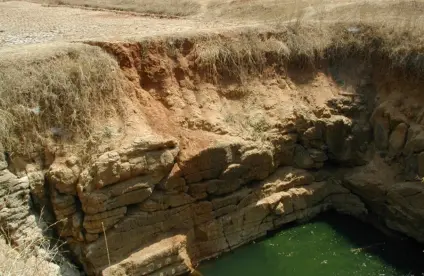
To better meet the need for knowledge of the subsurface, we must advance understanding of the processes that led to its formation and change through time. This objective involves undertaking research on novel concepts on old and current mountain ranges, sedimentary basin domains and surface domains.
Needs in this area include quantifying surface processes, including weathering and erosion, solid and solution flows and sedimentation, at different time scales, starting with the most recent: the Quaternary, the Holocene and the present day. This "source to sink" approach will include the quantification of past and present deformations.
Only by understanding the quantity and quality of geological processes and their impact on subsurface changes, including fluid and energy flows, can we build a model of the geometry and structure of geological units at a finer resolution as part of a predictive geoscience approach.
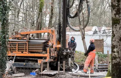
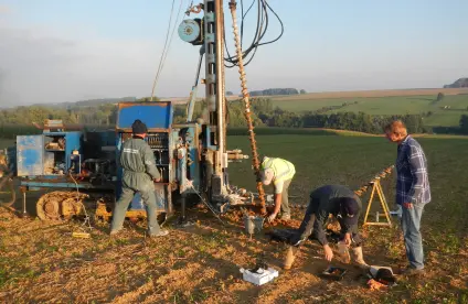
With this objective in mind and in collaboration with its partners, BRGM will continue to invest in the promotion, set-up and implementation of ambitious knowledge acquisition programmes in high-stake areas in France and abroad: 0-100 m boreholes and deep boreholes, new geological maps, ground and airborne geophysical acquisitions, and element and isotope geochemical infrastructures.
Research priorities
- Understanding crust dynamics and their impact on tectonic and sedimentary changes, and matter and fluid movements in orogens and sedimentary basins, as this is necessary to explore resources in these locations and manage hazards; this requires improving the dating of old and recent geological processes and units to better constrain our geological past.
- Quantifying the processes of weathering, erosion, translocation and sedimentation; in particular the processes of regolith formation and basin changes to meet prediction needs.
- Characterising current tectonics (e.g. long-wavelength deformations and active faults).
- Constraining current geological processes in relation to the dynamics of climate change.
Better characterise the geometry and properties of the subsurface
Understanding the architecture of the near-subsurface at different scales includes the characterisation of underground reservoirs for water, georesources and storage, and the regolith, a critical interface between the solid Earth and external envelopes, which are subjected to numerous anthropogenic and climatic stresses.
This involves characterising and parameterising the geometry of the subsurface in 3D. Multiscale "digital geological maps" must evolve to become 3D information systems collating complementary information on the subsurface, forming the basis for new digital services. We will need to provide services in order to answer questions such as: “What is the nature of the rock in an x, y and z location and what are its properties? How certain are we of this?” ; ?” We will need to process data (e.g. by carrying out thickness and depth calculations and projections as maps or sections, or by applying a predictive geoscience approach).
Work will first be carried out on RGF sites, including the new "Paris Basin" and "Alps and Peripheral Basins" sites.
Research priorities
- Collating available data into a coherent 3D system and acquiring new knowledge of the RGF sites.
- Developing new repositories for describing geological units for use by the national and international scientific community.
- Strengthening the collection, pooling and delivery of geological data/knowledge.

Scientific programme: Subsurface imaging and modelling
The programme has a strong technological component due to the instrumentation required to carry out underground investigations at an appropriate scale. An ambitious part of this programme is its digital and software focus. This is essential for processing and analysing recorded signals to produce a variety of outputs (e.g. maps, 3D models and geological grids).
A medium-term goal will be to propose methods and tools for building "digital twins" to simulate different subsurface uses, in connection with new digital capabilities, including interoperable repositories and artificial intelligence.
Deploy a range of more efficient, multiscale surface and subsurface geophysical imaging systems
BRGM's research in this area essentially focuses on adapting existing geophysical and other sensors. This will produce new types of higher-resolution imagery with a shorter implementation time and higher repetition rates, for example. R&D work will also be carried out on new measurement configurations (e.g. via the use of drones and adaptation to the urban setting), thus contributing to a renewal of underground imagery at novel scales.
Lastly, we will develop data acquisition methodologies in the context of a "multiscale" approach – one of BRGM’s valuable assets – combining laboratory and field work as well as proximal drone sensing, regional airborne imaging and global imaging by space imagers. Timelapse geophysical imagery is another field of investigation, which is increasingly being used to monitor natural or human-related underground phenomena over time.
Research priorities
- Equipping BRGM, on its own or in collaboration with partners, with innovative, combined ground- and dronebased imaging facilities for physical and chemical surface and underground characterisation.
- Consolidating a number of areas of co-development in geophysical instrumentation with our subsidiary Iris Instruments, such as the measurement of resistivity using a Multi TX-RX device or high-power transmitters.
- Strengthening our capabilities in geophysical measurement in boreholes and/or repeated measurement over time for the detailed characterisation of the unsaturated zone or the development of the urban subsurface, for example.
- Developing and enhancing our ground and subsurface imaging capabilities by combining tools and scales of investigation using laboratory as well as space-borne techniques.
Develop advanced image processing to provide fine-grained quantified descriptions of complex subsurface environments
Even though advanced processing is a "grey area” which is poorly exploited, it is proving to be a key step in the subsurface modelling process, improving signal quality and increasing productivity (e.g. semi-automatic filtering tools).
The next step is to optimise the integration of available signals and information through data fusion techniques, numerical analysis by modelling and inversion or multivariate predictive approaches. This will produce ground and subsurface models that are as detailed and realistic as possible.
Related to this is the need to assess uncertainty in the constructed models as this is critical to obtaining robust subsurface descriptions. Until now uncertainty has been poorly quantified. The aim is to extend our use of geostatistical approaches as well as broader probabilistic approaches to investigate the range of possible models and extract error indications from the models.
Research priorities
- Developing a variety of mono- and multisource predictive analysis/processing/mapping tools, with a view to improving quality, productivity and adding new products and/or services.
- Developing and enhancing our geophysical modelling and inversion capabilities, alone or in partnership, the goal being to develop working tools that give us an edge.
- Carrying out leading-edge research on the implementation of mathematical methods for estimating uncertainty and incorporating these methods in geological/geophysical modelling tools.
- Collaborating with our subsidiary Iris Instruments, to incorporate geophysical processing routines in our software.
Improve 3D digital geological information and interfacing with the applications used in subsurface engineering
Our ultimate goal in capturing the complexity of the subsurface is to go beyond images derived from physical properties, however fine grained, to 3D geological models (e.g. geometry of geological structures and units, and 3D fields of parameters) which are useful for targeted studies. The intention is for these models to provide a quantified common frame of reference for the dissemination of science findings and their translation into downstream applications.
This will require BRGM to integrate digital technology developments into its current tools (GDM-Multilayer and 3D GeoModeller) and tailor them to the changing needs of users and industry. We will need to improve and widen our geomodelling capabilities, probably by moving towards greater modularity and cross-cutting integration, and focusing on delivering services rather than on the tools themselves.
A major development will be to increase interactions between geological models and phenomenological models to simulate their behaviour. This will be based on the "digital twin" concept adapted from industry.
Research priorities
- Conducting leading-edge research on numerical methods in geostatistics and geological grids and applying these to geological modelling tools.
- Assessing the appropriateness of and initiating the convergence of BRGM's 3D geological and geophysical modelling tools, into what will eventually become a modular geomodelling platform.
- Developing numerical tools and methodologies for producing realistic 3D models of subsurface parameters at different scales and for a range of uses.
- Integrating a description of the subsurface into a conceptual functional model similar to an industrial-type “digital twin”, and linking this with subsurface engineering applications.

