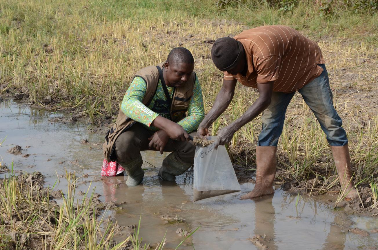
Taking samples of fine stream sediment in the Sidéradougou area in December 2015.
© BRGM - J.-F. Labbé
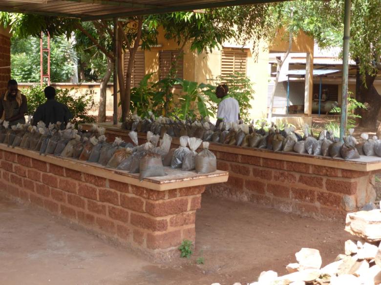
A delivery of samples to be checked at the BUMIGEB laboratory in Bobo-Dioulasso.
© BRGM - J.-F. Labbé
In order to maintain its mining sector, which is key to its economic development, Burkina Faso secured World Bank funding in 2011 to conduct a development support project for its mining sector.
One of the work packages aims to improve the availability and promotion of geoscientific information. Burkina Faso's Office for Mining and Geology (BUMIGEB), which is responsible for the work package, selected the BRGM for one of the technical components, a geochemical survey of stream sediments, which includes knowledge transfers to Burkinabé geologists.
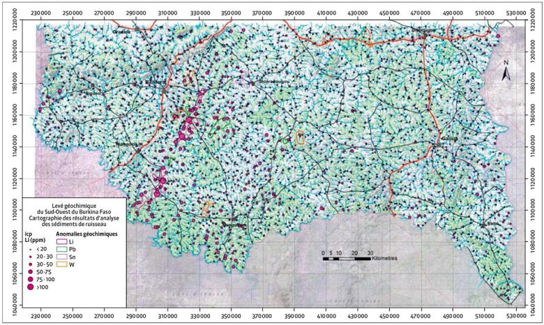
The plan was to take one sample per 10 km² over a total area of 36 875 km² covering the South-West (Gaoua) and Cascades (Banfora) administrative regions and the southern margins of the Hauts-Bassins region (Bobo-Dioulasso).
2 950 samples were actually taken, from a total area that excluded urban zones and the large marshy lowlands.
The methodology applied for this regional geochemistry survey involved taking samples of fine sediment (mud) weighing a few kilograms from streambeds at a collection point that was representative of the catchment basin in each sector. These sediments, which had leached down from the surrounding hills, are of interest to geologists as they can contain abnormally high quantities of certain metals that reveal geological concentrations and therefore potential deposits.
200 anomalies identified
The ground campaign lasted from October 2015 to February 2016. The samples were first sent to the BUMIGEB laboratory in Bobo-Dioulasso for drying, decompacting and sieving. The fine, dry fraction was then sent to the ALS-Minerals-Geochemistry laboratory in Ireland where it was analysed for gold and 48 other elements (including all the usual metals) using ICP-MS spectroscopy. The data were processed and results interpreted in May-June 2016, with a feedback session organised in Ouagadougou on 18 August 2016.
Altogether, over 200 geochemical anomalies were identified, of which 76 were of interest for their intensity, signature and litho-geochemical context. 56 indicate gold and the other 20 point to other substances including zinc, tungsten, tin, lithium and rare earths.
The interpretation of the results shows the remarkable effectiveness of the methodology applied after just 4 months of relatively exhaustive surveys over a very large area.
The survey results have produced a characterisation of large litho-geochemical units but have also defined and identified potentially mineralised zones. The maps produced - of the litho-geochemistry, geochemical anomalies and distribution of gold, antimony, nickel, lithium and other mineral concentrations - will be used to define targets for detailed exploration programmes aiming to identify economically viable deposits.

